Grain, Graphite, and Contours Above the Treeline

Today we journey into analog travel journals that blend film photography, on-the-spot sketching, and hand-drawn maps across mountain settings. Expect practical packing strategies, exposure wisdom in reflective snow, quick lines that catch fleeting clouds, and cartographic tricks that anchor memory. Along the way, I’ll share small trail stories from wind-chiseled passes and still dawn lakes, inviting you to slow down, notice more, and craft a backpack archive that feels alive in your hands long after footsteps fade.

Pack Light, Create Deep: Building a Mountain-Ready Analog Kit

A dependable kit begins with intention, not excess. In the cold, batteries sulk, fingers fumble, and straps catch on granite. Choose tools that welcome gloved hands and survive surprise squalls. Favor mechanical reliability, compact strength, and materials that forgive scrapes. Every gram you leave behind becomes attention you regain for light, line, and the climb. I learned this after hauling a heavy bag up a moraine, then sketching better with a pencil, a small camera, and a calmer breath.

Choosing a Resilient Film Camera and Lens Pairing

Mechanical shutters behave predictably in cold, and a simple prime resists fog and fuss. A 28mm invites sweeping ridgelines; a 50mm honors portraits at camp. Tape ISO reminders on the back. Keep a soft release for gloved presses, and a spare strap that won’t freeze stiff. Practice loading in dim tents by feel. When wind howls, fewer choices mean more attention where it matters: the angle of sun on snow, a pause in drifting cloud, a partner’s steady grin.

Sketchbook Pages That Survive Weather and Handle Speed

Choose paper that accepts pencil, ink, and diluted watercolor without buckling, ideally around 200–300 gsm with a subtle tooth. Spiral bindings catch; stitched blocks turn quietly in gusts. A modest A5 rides well in chest pockets. Binder clips tame pages on windy saddles. Waterproof ink pairs with graphite’s forgiving softness. A wax pencil ghosts over damp fibers. Slip a kneaded eraser into a small tin. The goal is quick starts, dependable surfaces, and pages ready for surprise color.

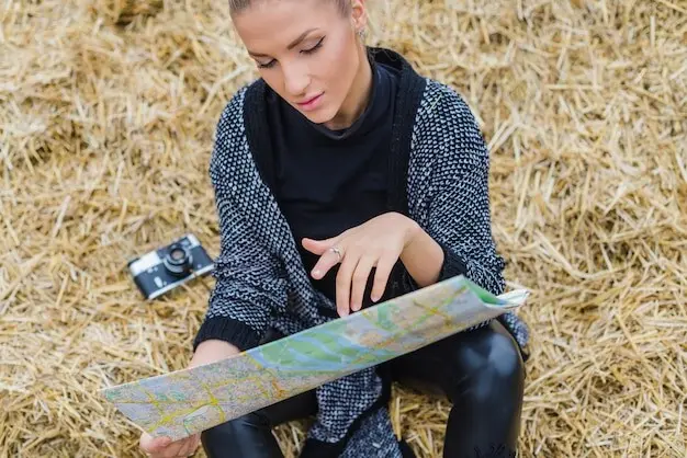
Mapping Tools You Can Trust When Trails Disappear

A tiny compass, a simple inclinometer, and a palm-sized ruler turn uncertainty into annotated confidence. Fineliners with waterproof pigment outlast sleet; a grease pencil marks slick map cases. Use light pencil grids to steady scale, then layer contour hints, cairn icons, and water symbols. Note magnetic declination in the margin, plus timing between landmarks. A foldable clipboard shields pages from spindrift. Reliable tools invite better questions: Where does that ridge funnel wind? Which gully holds shade? How steep feels safe today?

Chasing Alpine Light on Film

Mountain light shifts with theatrical speed, testing patience and rewarding preparation. Snow acts like a giant reflector, alpine lakes become mirrors, and thin air sharpens contrast. Choose stocks you trust and learn them like trails. Embrace bracketing when breath fogs your meter. Filters can rescue skies without crushing shadows. Keep notes, because film remembers faithfully only when you do. My first glacier sunrise was underexposed, but the bracketed frame held enough detail to revive the memory, cold toes and laughter included.

Sketching the Weather: Lines that Breathe Thin Air

When gusts slap pages and light bounces fiercely, drawing becomes a barometer for attention. Gesture lines catch mood before realism settles. Hatching suggests scree fields; negative space reveals cold brightness. Five unsteady minutes can yield truer presence than an hour indoors. Accept imperfection as trail dust on paper. I’ve watched ravens trace thermals over cornices, sketched with numb fingers, and later discovered those ragged strokes carried the sound of wind better than any photograph ever could.

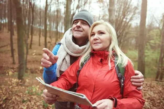
Maps that Tell You Where and Why

A hand-drawn map turns memory into navigable story, compressing climbs, pauses, and small joys into thoughtful symbols. Beyond accuracy, it explains choices: why the shaded traverse mattered, where water sang loudest, how a detour saved morale. Scale flexes to emphasize concern, not ego. The page becomes a conversation with terrain, stitched by bearings, timings, and care. I once traced a safer line around an icy slab using yesterday’s notes, then inked gratitude beside a tiny sketch of warm soup.

Designing a Clear Legend and Symbol Language

Consistency invites trust. Decide on line styles for paths, scree, snowfields, and glacier tongues, then stick to them. Use modest iconography: triangles for cairns, a wave for springs, a dot‑dash for intermittent streams. Encode risk with calm clarity, never drama. Include scale bars and north arrows, plus declination. Tuck a mini key into a corner, laminated tape guarding smudges. A careful legend frees your brain later, letting storytelling breathe while essential meaning remains legible through sweat, rain, and rapid decisions.

Tracing Elevation Profiles, Switchbacks, and Risk Zones

Profiles translate pain and pride into lines. Sketch ascent rhythm with gentle slopes, steep pitches, and sighing flats, marking water stops and exposed ribs. Dotted shading can show avalanche paths or loose talus. Label slopes with angles and footing notes gleaned from boot memory. Align the profile’s horizontal marks with time estimates, anchoring expectation. When storms move, update boldly. The goal is not artistry alone, but clarity that helps future you, or a partner, move with intention and measured confidence.

Annotating Sensory Cues and Cultural Landmarks

Maps feel richer when labeled with lived signals: the smell of resin where trail cuts through dwarf pine, a bell’s echo from distant sheep, the metallic whistle of wind through a rusted gate. Add seasonal notes for snow bridges or evening shade. Respect sacred spaces with careful icons and gentle language. Credit local names alongside official ones. These annotations turn navigation into relationship, reminding you that routes cross histories, habitats, and stories, not just contours and coordinates under a quick, consuming sky.

Resilience and Preservation: Weatherproofing, Drying, and Archiving

Mountains test paper, emulsion, glue, and resolve. Plan for wet, then be delighted by dry. Zip bags, waxed covers, and careful habits prevent damage better than any miracle rescue. Still, mishaps happen; preparation turns panic into procedure. Later, thoughtful archiving lets future you revisit crisp margins and vivid grains. Negatives filed safely, pages flattened gently, and good scans made with patient light become a second shelter. I’ve revived rain-curled sketches overnight with airflow, weight, and a patient, thankful mind.

From Trail to Tale: Weaving Photos, Sketches, and Maps into Story

Your pages already hum with effort; now arrange them so others can walk beside you. Alternate wide breaths—panoramas, big washes—with intimate pauses—boot prints, tea steam, a contour’s sly bend. Pair contact sheets with thumbnails of map insets. Let captions carry voice, not explanation alone. Invite readers to trace choices and feel weather. Share selections, ask questions, and welcome corrections from locals. Comment, subscribe, or send your own spread; together we’ll stitch a high-country anthology worth carrying forward.

Sequencing Spreads that Breathe

Begin with orientation—an opening map fragment and a quiet frame—before climbing into action. Vary rhythm: verticals for ascents, horizontals for rests. Slide a sketch between two photos to invite reflection. Use white space like silence between footfalls. End on gratitude, not conquest. Test multiple sequences on a table, then sleep on it. Morning reveals rough edges and kinder pivots. Sequence is choreography for the eyes, guiding attention up switchbacks, across shelves, and finally into the soft light of return.

Captions, Marginalia, and Voice

Write like you breathe at altitude: fewer words, more intent. Use captions to name decisions, not just places—why you chose the shaded traverse, how the meter lied kindly on ice. Margins hold jokes, coordinates, and promises to return. Let vulnerability travel with confidence. If a frame failed, say so, then celebrate the lesson. Consistent handwriting or a chosen type style helps readability. Voice becomes the trail’s echo, turning images and lines into a companionable conversation that lingers after the last page.

Share, Exchange, and Build a Community Atlas

Trade zines at trailheads, exchange scans with partners, and mail postcards stitched from contact prints and tiny maps. Host a small critique night where snacks soften nerves and kindness sharpens craft. Ask for route notes from locals and credit generously. Invite subscribers to vote on your next section to revisit or re-draw. Publish failures beside triumphs, so learning feels communal. Over time, your pages, their pages, and stray margin doodles gather into a shared atlas, stitched with wind, laughter, and care.
Mexonovitelidaxinexotarilaxi
Privacy Overview

This website uses cookies so that we can provide you with the best user experience possible. Cookie information is stored in your browser and performs functions such as recognising you when you return to our website and helping our team to understand which sections of the website you find most interesting and useful.